Yeoncheon County
Yeoncheon
연천군 | |
|---|---|
| Korean transcription(s) | |
| • Hangul | 연천군 |
| • Hanja | 漣川郡 |
| • Revised Romanization | Yeoncheon-gun |
| • McCune-Reischauer | Yŏnch'ŏn-gun |
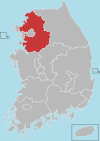
 Location in Gyeonggi Province | |
 | |
| Coordinates: 38°06′N 127°05′E / 38.100°N 127.083°E | |
| Country | |
| Region | Sudogwon |
| Administrative divisions | 2 eup, 8 myeon |
| Area | |
• Total | 675.22 km2 (260.70 sq mi) |
| Population (September 2024[1]) | |
• Total | 40,894 |
| • Density | 61/km2 (160/sq mi) |
| • Dialect | Seoul |
Yeoncheon County (Yeoncheon-gun) is a county in Gyeonggi Province, South Korea. The county seat is Yeoncheon-eup (연천읍) and sits on Gyeongwon Line, the Korail railroad line connecting Seoul, South Korea (ROK), with North Korea (DPRK).
History
[edit]A variety of paleolithic relics have been discovered at Jeongok-ri, first in 1978.[2][3] Since 1993 the Yeoncheon Jeongok-ri Paleolithic Festival has celebrated the discovery.[4]
Yeoncheon was the site of the Battle of Yultong during the Korean War, where the Philippine 10th Battalion Combat Team defended their position during the First Chinese Spring Offensive.
In August 2015, over 100 civilians were evacuated from the area after North and South Korea exchanged artillery fire.[5][6]
Administrative districts
[edit]The city is divided into two eup (towns) and eight myeon (townships):
| Town/Township | Hanja | Population | Households |
| Yeoncheon-eup | 漣川邑 | 6,707 | 3,100 |
| Jeongok-eup | 全谷邑 | 20,872 | 8,522 |
| Gunnam-myeon | 郡南面 | 3,549 | 1,704 |
| Cheongsan-myeon | 靑山面 | 4,606 | 2,333 |
| Baekhak-myeon | 百鶴面 | 2,857 | 1,263 |
| Misan-myeon | 嵋山面 | 1,755 | 845 |
| Wangjing-myeon | 旺澄面 | 1,155 | 579 |
| Sinseo-myeon | 新西面 | 3,268 | 1,707 |
| Jung-myeon | 中面 | 261 | 145 |
| Jangnam-myeon | 長南面 | 678 | 307 |
Climate
[edit]Yeoncheon has a monsoon-influenced humid continental climate (Köppen: Dwa) with cold, dry winters and hot, rainy summers.
| Climate data for Yeoncheon (1999–2020 normals) | |||||||||||||
|---|---|---|---|---|---|---|---|---|---|---|---|---|---|
| Month | Jan | Feb | Mar | Apr | May | Jun | Jul | Aug | Sep | Oct | Nov | Dec | Year |
| Mean daily maximum °C (°F) | 1.8 (35.2) |
5.1 (41.2) |
11.5 (52.7) |
18.7 (65.7) |
24.6 (76.3) |
28.5 (83.3) |
29.8 (85.6) |
30.8 (87.4) |
26.6 (79.9) |
20.4 (68.7) |
11.6 (52.9) |
3.2 (37.8) |
17.7 (63.9) |
| Daily mean °C (°F) | −4.7 (23.5) |
−1.3 (29.7) |
4.8 (40.6) |
11.5 (52.7) |
17.6 (63.7) |
22.3 (72.1) |
25.0 (77.0) |
25.5 (77.9) |
20.3 (68.5) |
12.9 (55.2) |
5.3 (41.5) |
−2.6 (27.3) |
11.4 (52.5) |
| Mean daily minimum °C (°F) | −10.5 (13.1) |
−7.2 (19.0) |
−1.6 (29.1) |
4.6 (40.3) |
11.2 (52.2) |
17.0 (62.6) |
21.3 (70.3) |
21.5 (70.7) |
15.2 (59.4) |
6.9 (44.4) |
−0.2 (31.6) |
−7.8 (18.0) |
5.9 (42.6) |
| Average precipitation mm (inches) | 15.4 (0.61) |
22.7 (0.89) |
29.1 (1.15) |
61.5 (2.42) |
84.2 (3.31) |
112.1 (4.41) |
379.7 (14.95) |
346.6 (13.65) |
133.5 (5.26) |
52.9 (2.08) |
44.0 (1.73) |
14.1 (0.56) |
1,295.8 (51.02) |
| Average precipitation days (≥ 0.1 mm) | 3.1 | 3.9 | 5.7 | 7.4 | 7.0 | 8.8 | 14.5 | 12.9 | 7.1 | 5.5 | 6.9 | 5.0 | 87.8 |
| Source: Korea Meteorological Administration[7] | |||||||||||||
Sister cities
[edit] Zoucheng, Shandong, China
 Shibata, Niigata, Japan
 Imus, Cavite, Philippines
 Palmdale, California, United States of America
See also
[edit]References
[edit]- ^ "Population statistics". Korea Ministry of the Interior and Safety. 2024.
- ^ "Prehistoric Culture Administrative Center". Archived from the original on 17 May 2008. Retrieved 21 July 2018.
- ^ "Prehistoric Site in Yeoncheon". world.kbs.co.kr. 29 April 2013. Retrieved 21 July 2018.
- ^ "South Korean Festival Offers Paleolithic Experience". koreabizwire.com. 4 May 2017. Retrieved 21 July 2018.
- ^ "North Korea exchanges fire with South Korea". The Telegraph. 20 August 2015. Retrieved 21 July 2018.
- ^ "North Korea and South Korea Trade Fire Across Border, Seoul Says". New York Times. 20 August 2015. Retrieved 21 July 2018.
- ^ "Climatological Normals of Korea (1991 ~ 2020)" (PDF) (in Korean). Korea Meteorological Administration. Archived from the original (PDF) on 29 January 2022. Retrieved 7 June 2023.
External links
[edit]


